
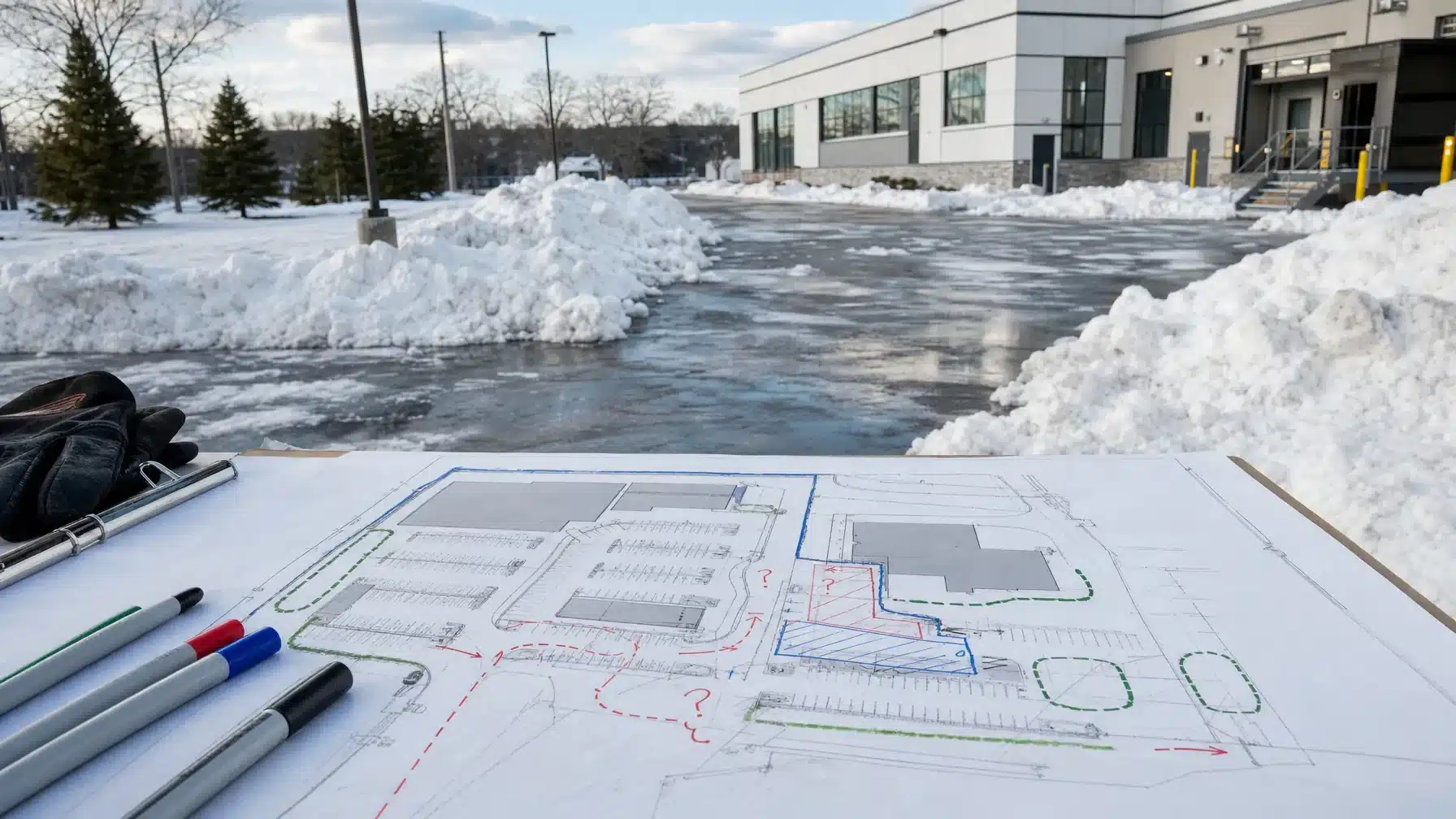
Before reviewing a commercial property with a snow-plowing provider, mark where you propose storing snow, what must remain accessible, which visible features need attention and which questions remain unresolved. Pair those map markings with a worksheet so the provider can understand the reason behind each proposal.
For Merrimack Valley property managers, the useful deliverable is a discussion map—not an instruction to begin placing snow in every marked area. Keep owner-proposed locations visibly separate from locations confirmed through site-specific review.
This worksheet addresses the storage-location portion of preparation. For broader decisions about service activation, priorities, communications and event records, use the commercial snow and ice management plan alongside it.
Use an available property plan, aerial image or simple sketch. Label the property and building entrances, and add recognizable landmarks so reviewers can match the drawing to the ground. If the base image does not reflect current conditions, mark the differences rather than leaving them for the provider to discover.
Describe the access need, not just the pavement. A lightly used corner may still provide delivery access or connect a walking route. Record those uses before proposing it as storage.
Put the legend directly on the map. Use letters and line patterns as well as color so the distinctions remain readable on a printed copy. Give each proposed area a unique letter label and use that same label on its worksheet entry.
Note An empty area is not automatically a suitable snow-storage area. Keep it marked as proposed until adjacent access, site features and owner-known restrictions have been reviewed. If a question remains open, leave the question visible.
Walk the property while features are visible. Mark curbs, parking islands, speed bumps, utility covers, signs, fences, gates and landscape edges near proposed storage. Also identify visible catch basins, low spots and drainage paths, along with locations where property staff have observed water collecting or refreezing.
Separate observation from interpretation. Record that a catch basin is beside a proposed area; do not assume the location is acceptable or prescribe a drainage fix. Note a possible sight-line conflict at an exit as a question for review rather than drawing an unsupported pile limit.
Add restrictions property management already knows: shared access arrangements, tenant-reserved spaces, boundaries, landscape areas that must not be used or permission that has not been obtained. Where a boundary or restriction is uncertain, identify who can clarify it. Do not present a guess as an established property condition.
Keep the worksheet beside the map rather than crowding every detail into the drawing. Repeat the following fields for each proposed location.
A blank concern field is ambiguous. Write “not yet reviewed” if the area has not been assessed. When clarification is needed, name the issue and the person responsible for resolving it so it does not disappear between conversations.
Bring the marked map and worksheet to the provider walkthrough. Visit each proposed location and compare it with the access routes and obstacles you recorded. Ask the provider to identify placement concerns or conflicts; leave pile dimensions, setbacks and equipment movements to site-specific review rather than prescribing them in the draft.
Before treating the map as an operating document, distinguish confirmed locations from pending decisions and make the current version identifiable. Revisit it when construction, parking use, tenant operations or access arrangements change. A reviewed location should not silently become a substitute for a different area.
McLeod Landscaping offers snow plowing for commercial properties. Learn about its commercial snow-plowing services, and use your proposed map to organize a property-specific discussion about access and snow storage.
Contact McLeod Landscaping today at (978) 640-0957 or click here to schedule a consultation for retaining wall installation. Let our experienced team design and install a functional and visually appealing retaining wall that enhances your landscape.

1881 Main St Unit 1, Tewksbury, MA 01876